Gravedona-Dosso-Peglio
Advanced L4 - Gravedona – Dosso – Peglio
DEPARTURE/ARRIVAL
From: Gravedona
To: Gravedona
TYPE/PERIOD
Mountain Bike / E-mtb
Autumn / Spring / Summer
Duration/Length
3 hours
12 km
CHANGE IN ALTITUDE
Uphill: 625 m
DIFFICULTY
Advanced

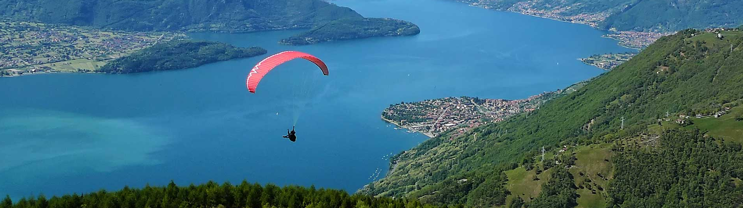
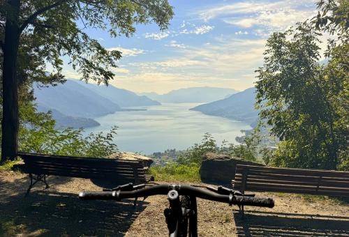
The route starts in the municipality of Gravedona ed Uniti, from the car park on via San Gusmeo, not far from Palazzo Gallio. You start uphill on a paved road that leads to Dosso del Liro, passing through the Negrana area from the S.P. 4. In some sections the road is very steep, the use of an electric bicycle (e-bike) is recommended. Once you reach Dosso del Liro, continue by following Via dei Monti Lariani, a trail that develops along the coast. The stretch offers a series of ups and downs that cross the mountain. The route is characterized by breathtaking views. You reach the Ronzone stream where you need to cross a bridge on foot, holding the bike by hand. After the bridge, continue by following the stairs to a signpost. From this point, continue with a short succession of climbs and descents. Then you arrive at a forest road that leads to the Church of the Madonna del Gorghiglio in the village of Peglio. From Peglio, you start a climb on a paved road that leads to the Church of Santa Croce di Naro and, along beautiful well-maintained mule tracks, you descend. It is necessary to pay attention to driving for the marked slopes. The route ends with the return to Gravedona ed Uniti. This route offers a complete cycling experience, with challenges both uphill and downhill, as well as stunning views. It is possible to refuel with water at several points. The ascent in an e-bike is recommended, without the assistance of the engine this route can be extremely challenging in the steepest sections.


Cities crossed by the itinerary

Watch the itinerary video

Fotogallery

Mulattiera di Naro
Chiesa della madonna di Gorghiglio
Ponte sul Ronzone
Punto panoramico di Naro
Chiesa di Santa Croce

Point of Interest

Itinerary Data

hedaer

A new cycle network has been created in the Upper Lake Como area. There are 23 routes in two large areas along the lake's shores, for a total of 380 kilometers. Two routes are for beginners, 10 for intermediates, 8 for advanced cyclists, and 3 for experts. The difficulty scale and route tracking were verified by CAI experts, and an international evaluation standard was adopted in agreement with the Lombardy Region.


Along the routes, there are many panoramic points where you can admire the stunning beauty of Lake Como. The app provides all the information you need to safely navigate the routes, including directions to equipped areas, places of art and culture to visit, and events scheduled in the towns along the chosen route. You can also watch videos of the best panoramic views.


THE CYCLE ROUTES OF THE WESTERN NORTH LAKE COMO - There are 8 new routes at mid-mountain and high altitude, for a total length of 134 kilometers. The routes connect to existing connections between mountain towns and lakeside towns, where there is already a cycle path. The routes start in Sorico and pass through Montemezzo, Vercana, Trezzone, Livo, Peglio, Dosso del Liro, Gravedona ed Uniti, Stazzona, Dongo, Garzeno, Pianello del Lario, Musso, and end in Cremia.


THE CYCLE ROUTES IN THE VALSASSINA - There are 15 routes that allow you to climb from the lake to the Valsassina and Valvarrone, taking advantage of the trails on Mount Legnoncino; the loop circuits in the North Valsassina; the connections with the Valsassina cycle path; and the routes of the Val d'Esino.


WHAT ARE INTERNAL AREAS AND THE "UPPER LAKE COMO AND VALLI DEL LARIO" STRATEGY? - The "North Lake Como and Valli del Lario" Area Strategy was launched in 2018 as part of the National Strategy for Internal Areas 2014/2020. It involved 31 municipalities in the Valsassina, Valvarrone, Val d'Esino, and Riviera (Lecco) communities and the Valli del Lario and Ceresio communities (Como). The National Strategy for Internal Areas (SNAI) is a strategic plan designed to enhance and develop internal areas, which are often characterized by challenges such as depopulation, lack of services, and fewer economic opportunities. The goal is to promote the sustainable development of these areas by investing in infrastructure, services, the local economy, and the preservation of cultural and natural resources. The "Upper Lake Como and Valli del Lario" Area Strategy, implemented in the period 2018/2023, has made it possible to implement 31 projects for a total of 20 million euros, of which 5,285,000 euros were used to promote interventions to recover and enhance the heritage and to strengthen the cycle and hiking routes between the lake and the valleys.

Install app

GO
What is a PWA? Progressive Web Apps are a hybrid of mobile app and Web site: it is a technology that runs on the browser and does not require downloads from the app store, which contains Web pages just like a site. Through the install command on the browser you can create a quick link on your smartphone.